- Apply
- Visit
- Request Info
- Give


Published on May 03, 2024
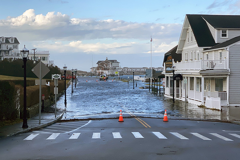
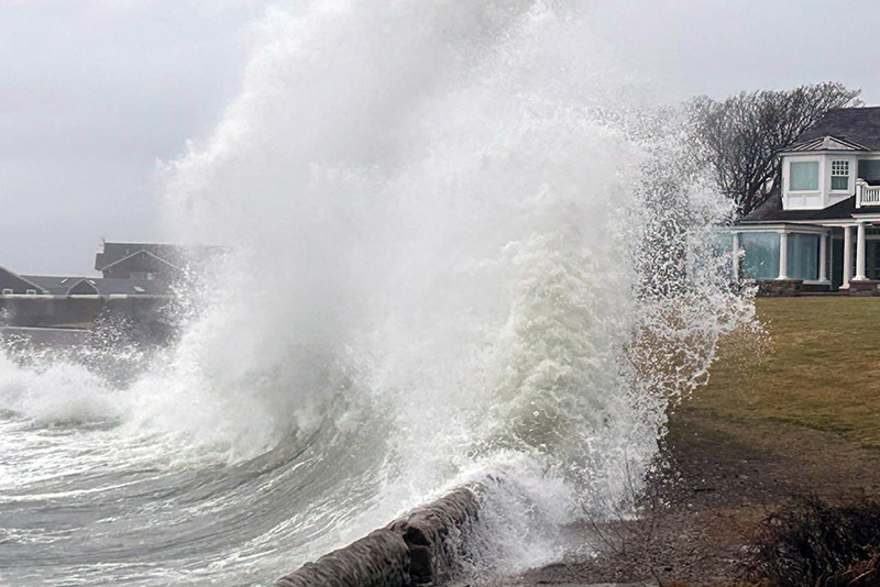
Bay Street in downtown Watch Hill, following a storm in January 2024
As sea levels rise, even small storms can have catastrophic impacts. This was the message from environmental earth science Professor Bryan Oakley following a streak of stormy weather this winter that left the picturesque seaside community of Watch Hill, RI, three feet underwater.

“The storm surges we’re observing today give us glimpses of sea level rise in the future,” said Oakley, a coastal geologist, adding that three feet of sea level rise is a very real possibility later this century.
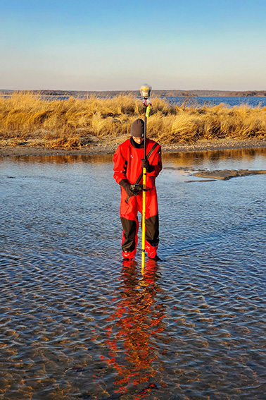
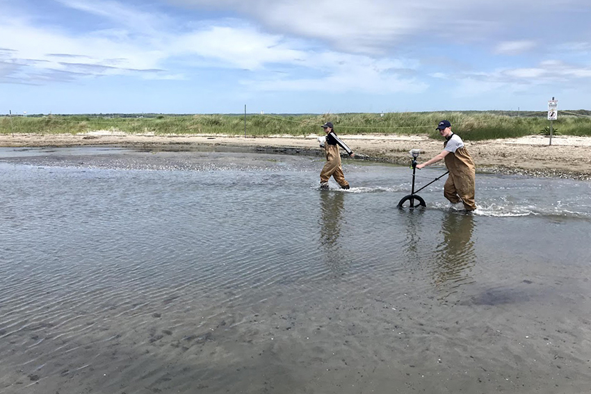
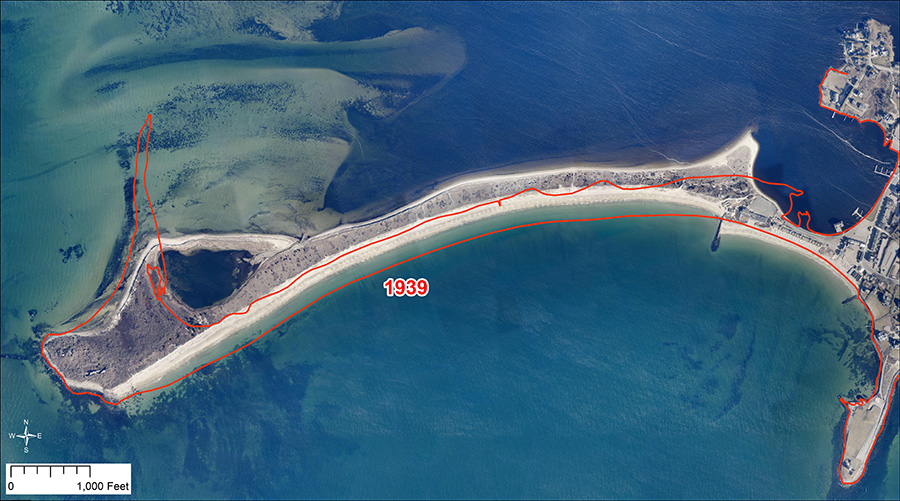
For the past 12 years, Oakley and his students have been studying storm-driven shoreline change at Napatree Point, a mostly undeveloped barrier spit adjacent to historic Watch Hill. A rarity for the built-up coast of southern New England, this pristine landform allows scientists to monitor shoreline behaviors in their natural state.
“Monitoring the coastal ecosystem of Napatree Point helps us to examine shoreline changes over time with minimal human interruption,” said Oakley. “As storms become more frequent and intense, this allows us to predict what future conditions might be like.”
Storms drive shoreline change with strong waves and surges that “overwash” and erode dunes and barriers. Furthermore, as storms increase in frequency, shorelines have less time to recover between events, making them increasingly susceptible to the turbulent sea.
“Recovery of the beach takes weeks, recovery of the dunes takes years,” said Oakley, explaining that sand deposition by the churning ocean recovers the beach, whereas windblown processes restore dunes — a much slower recovery.
Demonstrating how mobile shoreline features can be, Oakley has found that the Napatree barrier has moved one full width landward in the years since the Great Hurricane of 1938 — a distance of approximately 100 meters.
Communicating this research to the greater Watch Hill community is the other half of Oakley’s efforts. Through his course “Coastal Geologic Hazards,” students recommend mitigation strategies to counter the threats of sea level rise, coastal erosion and storm surge. To facilitate this outreach, Oakley serves as a science advisor with The Watch Hill Conservancy.
“Dr. Oakley and his students are incredibly active on Napatree and provide critical information that directs our management activities,” said Daniel Cole, conservation area manager with The Watch Hill Conservancy. He pointed to the Eastern group’s work measuring changes in dune elevation, tidal flushing, the ecology of green crabs in the Napatree lagoon and the extent of seagrass habitat off the Napatree shore.
“Dr. Oakley’s expertise in barrier beach dynamics and his quarterly GPS-based elevation transects allow us to understand the timing of dune recovery following large storms,” said Cole. “And his students’ creative solutions to mitigate the impacts of sea level rise on this village and those like it prompt lively discussions.”
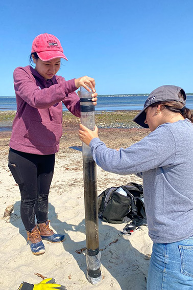
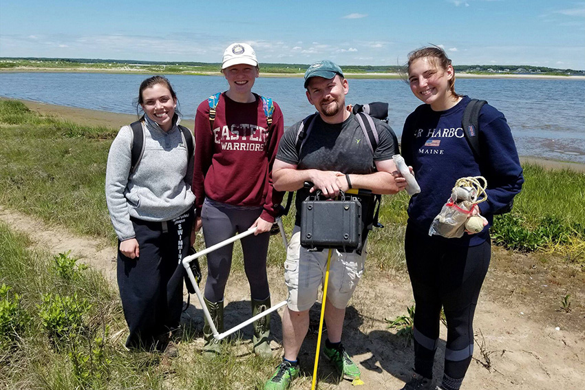
Olivia Gentile '24 (left) and Daria DiBiaso '25 conduct sediment coring on the Napatree barrier to better understand the impact of past storm events.
In describing a class assignment, senior Jonathan Lepire said, “We were tasked with creating three different mitigation plans for the Watch Hill community against flooding and storm surge when accounting for two feet of sea level rise.” Their strategies included constructing a boardwalk to maintain beach access; bolstering the existing beach with large geotextile tubes to protect against storm surge; and extending a sheet piling seawall to prevent — or delay — the sea from advancing inland.
Oakley says that most of the available mitigation strategies are covered in the acronym REAM — retreat (from the coast), elevate (structures), adapt (by allowing water to pass through), and mitigate (by adding artificial barriers).
Of all these strategies, however, he says “retreat” is the only sure solution. “Coastal communities need to think forward by moving back, to lessen impacts in the future.” After all, “sea level is not going down.”
Written by Michael Rouleau